Field map API
THE SMART CHOICE TO IMPROVE YOUR DIGITAL FARMING APPS, STRENGTHEN YOUR SAAS BUSINESS AND INCREASE THE NUMBER OF USERS.
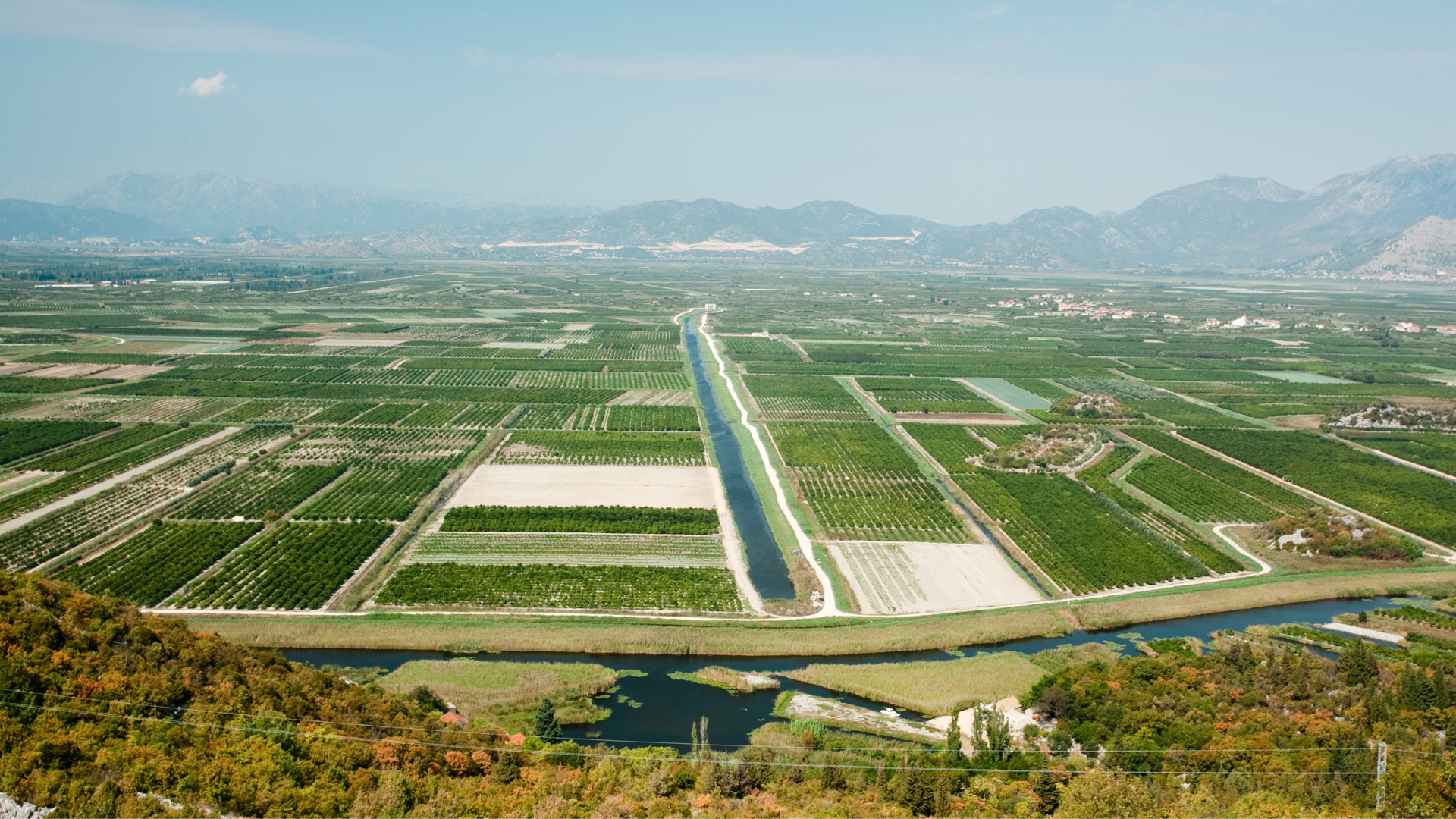
Our intelligent API platform provides access to satellite-based field information (both historical and current) on plant and soil health. Up-to-date information from our APIs helps to significantly improve agricultural decision-making processes. Request your API test key or book a call.
Maps Suggestions
Features and benefits

Dry matter map
This map shows the dry matter in t/ha. Dry matter is an important indicator because it corresponds to the growth of the plant. Dry matter is also known as anhydrous biomass or “dry weight” of plants.

Vegetation index maps
There are a variety of different, well-studied vegetation indices that provide valuable insights into fields and can be used for tailored advisory services.

Nitrogen uptake map
The nitrogen uptake map shows the amount of nitrogen in kg/ha that plants have absorbed from fertilizers, mineralization and other sources.

Soil productivity map
Plant growth in a field often varies greatly. Our soil productivity map identifies growth differences from long-term satellite data observation.
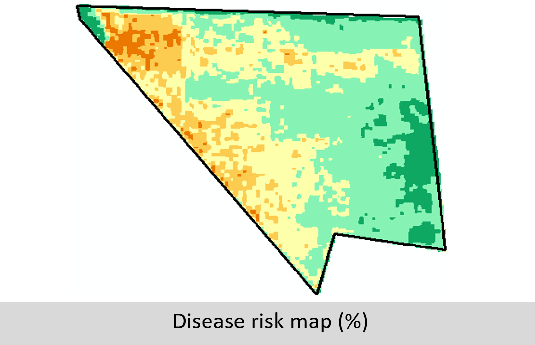
Disease risk map
This Disease risk map allows users to identify the likelihood of plant disease infection in different zones in a field. Disease risk is estimated based on current leaf area index (or dry matter), soil productivity map and field topography.
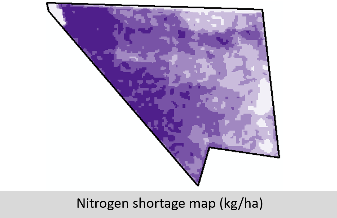
Nitrogen shortage map
The nitrogen shortage map shows the current difference to an optimal nitrogen supply in kg/ha. When calculating the undersupply, all influencing factors such as mineralization etc.